Maps are invaluable to the writer, especially when there is no other way to access the setting of a bygone era. I am especially drawn to maps since my first published outing of a fourteenth century London for my Crispin Guest Medieval Noir mysteries.
Through maps, I could see the evolution of London itself, from a three-square mile habitation still behind the old Roman walls, to the later creep into the nearby city of Westminster. Not much has remained the same of the London of that past. During the fourteenth century, Westminster Abbey was being remodeled to what you would expect to see today, with its Purbeck marble columns to its vast interior spaces. Westminster Hall would only remain into modern times exactly as Richard II’s craftsmen reworked it, especially its hammerbeam ceiling that negated the need for columns. But Westminster Palace would be razed and rebuilt into the Parliament buildings we see today with Big Ben’s Tower near Westminster Bridge between 1840 and 1870. St. Paul’s Cathedral, seen large in the map below, had a center steeple, not a dome. That was much later when Christopher Wren designed it between 1675 and 1710. This map below represents features that are long gone or much changed.
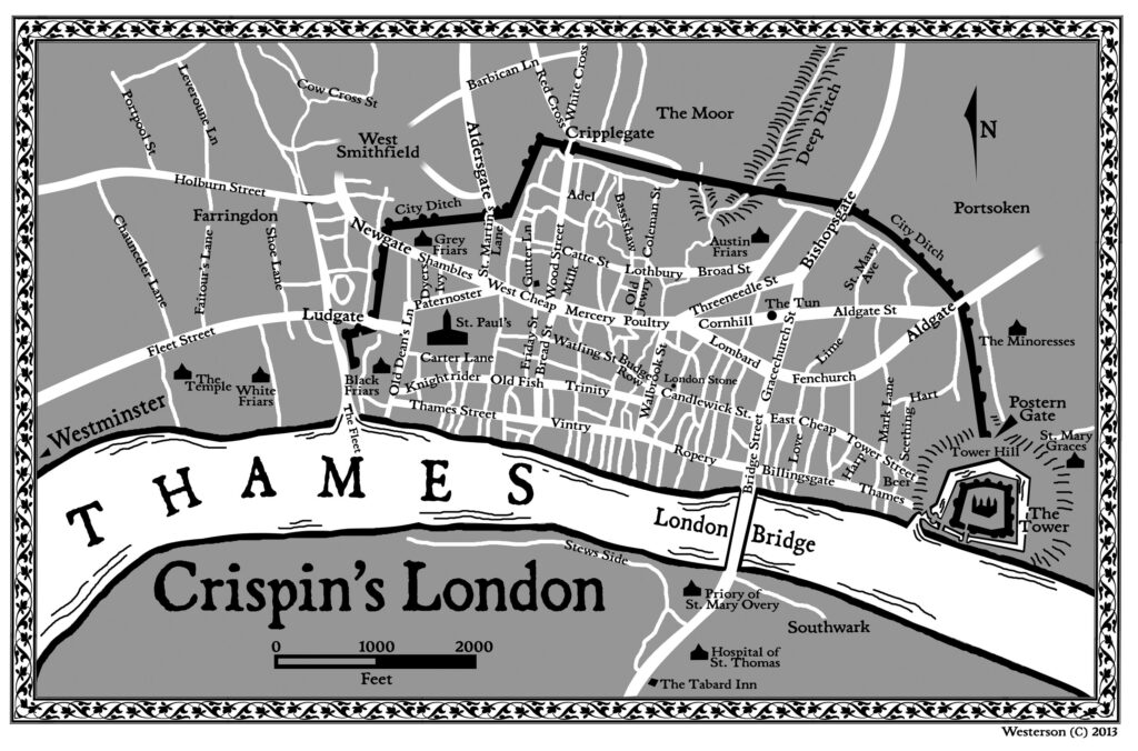
Map I created for the series
As I moved into Tudor London for my King’s Fool Mysteries, the city itself had oozed farther toward Westminster, and some of the open pastureland was taken up by housing and shops. That, too, is a different face of London, a more metropolitan place, a true seat of government (even though the court tended to move around based on the seasons and the whim of the monarch to the many palaces owned by the king). There was still only one bridge, London Bridge, approximately where the many iterations of it have been situated throughout the centuries. The Romans built a wooden structure…that always seemed to catch on fire, and washed out century after century. It wasn’t until Henry II’s day that he formerly took charge of it and built it of stone from 1176 t0 1209. It was still rebuilt several times and during the fourteenth century, even had its own parish built atop it with houses, shops, and even a chapel. They charged a toll to cross it, thereby, paying for the upkeep. The only other way across the Thames was to hire a boat.
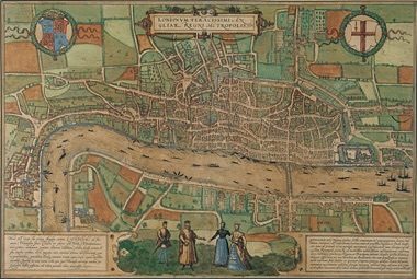
Late Tudor Map. The Tower is to the right of the bridge.
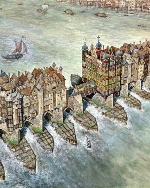
Medieval London Bridge
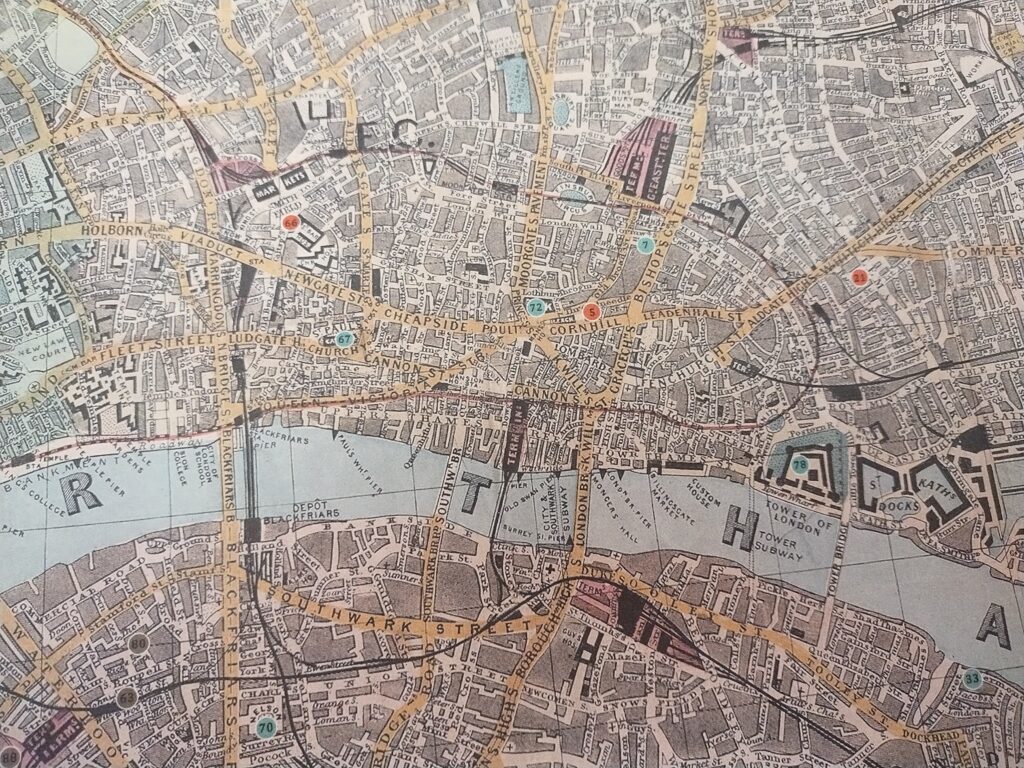
By the Victorian era, there was the Reynolds Distance Map of London, With the Recent Improvements, 1891, best for my purposes in the time period I’m writing about for my An Irregular Detective Mystery series, a Sherlockian Pastiche. I love this map, because it names ALL the streets, shows the omnibus routes and which one picks up where, the train stations and the railway lines like arteries spread all over a very dense London now. Remember, in sixteenth century Tudor maps, more land was taken over by houses and shops, but its still essentially a medieval city. And thatched roofs were outlawed, because if one house goes, it would set off so many others. The roofs had to be red clay tiles, slate, or lead for churches. The exception was the thatched roof of the theatres in Shakespeare’s day, but they were on the other side of the tracks, so to speak, across the Thames on the Bankside in Southwark. Of course, fire was the thing that took out The Globe, when some cannons misfired during the performance of the The Famous History of the Life of King Henry the Eighth, ironically enough. That was the end of The Globe.
There had been fires in London, hence the decree that no structures within the city should have thatched roofing. And that held until the NEW Globe Theatre was built near the same spot in 1997, being as faithful as they could to the 1599 version, and incorporating some of the 1614 replacement. It is the only thatched structure allowed in London.
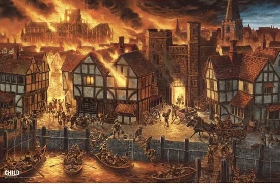
But in 1666, London experienced its worst fire to date. It destroyed most of London. All those half-timbered buildings just went up in smoke. Which is why the London of today looks very little like the London of yesteryear.
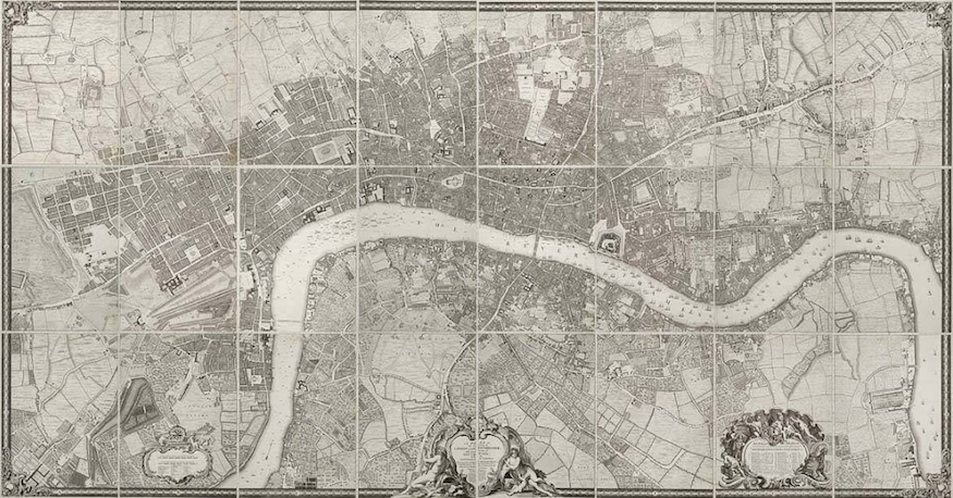
Here’s a nice old map of London by John Rocque, 1746. Downright modern. Still some farmland on the Southwark side of the Thames. You can clearly see the Tower of London, between the upcurve of the Thames to the right, and the downcurve of the Thames into Westminster on the left.
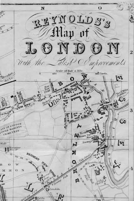
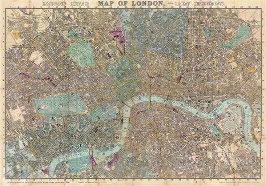
The last of the wild lands were tamed, the swamps drained and built upon to be some of the wealthiest neighborhoods in town; Belgravia, Mayfair, Knightsbridge…
Look at the difference of this map above to the first map I posted. There are many more bridges spanning the Thames, The original London was only that middle-right where a railway line follows the path of the old Roman wall, taken apart stone by stone for use in new foundations (see close-up map directly above).
Because of the character of London in each of these timelines, it influences how the characters react and feel about themselves and the old town itself. In the Middle Ages, it seemed enormous to the inhabitants, and mighty, strong enough to conquer, to strike out upon the seas to take, to explore.
Through Tudor times, it spread in a crawl. And by the time we are in Queen Victoria’s age, London is mighty indeed, the crowning glory of an empire on which the sun never set. But of course, it was to change once more with the times, still maintaining its integrity as a metropolitan European capital, with new towers to be built, new Underground stations to create, a London Eye to be erected, a Millenium Bridge to construct. But even so, London itself still carries on, and still inspires imagination by slowly revealing its secrets of the past. That’s what I love about it.
ADDENDUM: I forgot to mention one of the most important of social science’s maps, Charles Booth’s map. Booth was a social reformer (and it helped he was a shipbuilder so he had the money to put this together. It is his groundbreaking Maps Description of London Poverty in 1886 to 1903. It maps out all the neighborhoods in their various levels of poverty and financial stability. Invaluable for social reforms (and for authors writing about it some hundred plus years later). It’s Charles Booth’s Poverty map and it can be found here.
Discover more from Jeri Westerson
Subscribe to get the latest posts sent to your email.
The medieval London Bridge was like a floating city! People must have been amazed at the sight.
Don’t forget to check out the addendum. A most important map I forgot to mention.
You can’t let real estate like that go to waste.